News
March 3, 2022
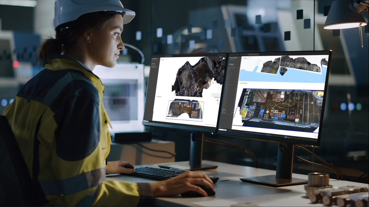
Get complete overview with the new Maps software
Optilift launches new software that delivers updated 3D images online of the real- time situation on vessel decks, rigs or quays.
– This is the maritime industry’s version of «street view», but in real-time. The function makes it possible to plan loading and unloading operations faster and much more precisely. Misunderstandings and costly double work are avoided, says Camilla Nylund, Managing Director of Optilift.
Lack of knowledge about the current situation on a ship deck, a rig deck or at the quay, today creates headaches and hassle for both operation- and logistics personnel in the offshore industry. How much free space is there in the loading area, and how are containers placed? Today, this mapping is usually done manually, or maybe not at all. The information may arrive late, and there is a risk that it ́s not fully updated. Effective planning becomes hard or even impossible.
Important improvement
Maps is a new feature in the company’s Digital Logistics software suite, which digitizes planning, loading and unloading operations. The software collects and processes images from a camera-based sensor mounted on the crane boom tip. The system automatically generates 3D models and images of the loading area. Remote personnel can zoom in and see the loading area or vessel deck from different angles and get a precise overview of the situation.
Nylund says the software provides a lot of useful information.
– It captures changes that occur and updates the 3D images continuously as the lifting operations occur, so that decisions and planning can be made based on the actual situation on deck.
Follow your vessel
Deck Planner which hosts the Maps feature is connected to among other the AIS- system provided by The Norwegian Coastal Administration (NCA). With this tool you will always know where the vessel is located. An overview map on the screen shows real-time position of your vessel. Nylund says the company has worked for a couple of years to develop and integrate Maps into the Deck Planner and overall Optilift solution. It is one of several features that by Q2 2022 will add up to a fully digitized cargo planning and handling system.
Contact us about the Maps feature.
Read more about Maps here.
Read more about Digital Logistics here.